Archaeology and Landscape in the Trent Valley by Howard Fisher
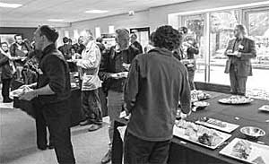
Lunch at BGS. If you think you know the person standing in the window you probably do from TV – it is Phil Harding.
The fourth Trent Valley GeoArchaeology Conference was held at British Geological Survey, Keyworth on Wednesday 15 May 2013. An excellent venue with all necessary facilities and plenty of room for delegates to enjoy coffee during the breaks and a good buffet lunch.
There had been eleven speakers scheduled but, unfortunately, one was unable to attend.
An audience of about a hundred enjoyed the ten talks which were delivered on the day and there were copies of the new A4 booklet Aggregates and Archaeology in Nottinghamshire (reviewed in this issue) available for all delegates.
The speakers all kept to their time slots, controlled by the Chairs of the sessions, essential for the smooth running of the day, which was achieved in full.
THE TRENT-SEVERN CORRIDOR IN THE FINAL MAGDALENIAN – Prof. Paul Pettitt, University of Durham
In the Late Pleistocene period Britain was still joined to the continent and could be viewed as the westernmost edge of the Great European Plain. The talk examined the hunter-gatherer people who populated Britain and suggested that the great rivers (Trent, Severn, Great Ouse and Thames) facilitated the movement of peoples and animals on a seasonal basis.
Reindeer appeared without any obvious natural predators around 17.2 – 17.8 La cal BP and horses are known from 14800 – 14200 cal BP along with reindeer, red deer, auroch, mammoth, arctic hare and brown bear. The hunter-gatherer peoples followed the animals as they migrated and, of course, they left indications of their occupation in the way of artefacts, indications of tool manufacture and of their art.
The hunting of horse and red deer in winter was possibly aided by the use of dogs. In Spring in the Peak District reindeer would be calving and so easy prey and speculatively horse would be hunted. Summer occupation was shown by two pieces of worked amber (Cresswell and Gough’s Cave) and Autumn would see the hunting of arctic hare which would provide for clothing replenishment as well as food.
At Cresswell pilot LA ICP-MS analysis suggests that some lithics derive from the Vale of Pewsey and it can be suggested that there are samples from all the sources of British flints.
There are similarities between British and Continental sites which indicate a similarity of peoples.
Whilst stating that a lot of work remains to be done on this subject, the speaker firmly suggested that rivers, including the Severn and Trent provided the main nodes of seasonal movements during the period.
THE GEOARCHAEOLOGY OF THE A46 PROJECT: INVESTIGATIONS OF THE TRENT VALLEY AND ITS TRIBUTARIES – Neil McNab, URS Infrastructure & Environment UK Ltd. and Dr. Michael J. Grant, Wessex Archaeology and Centre for Earth and Environmental Science Research (CEESR), School of Earth Sciences and Geography, Kingston University
Archaeological excavations as part of the A46 improvement work from Widmerpool to Newark produced nationally important remains along the route. The speakers concentrated on two sites, Farndon Fields and Margidunum both of which yielded nationally important geoarcheological datasets.
At Farndon Fields Trent & Peak had done work in the 1990s so the site was known but the opportunity provided by the A46 construction work has greatly advanced knowledge of the site and the excavated open-air Creswellian and Federmesser sites, some found in-situ, can now be placed within a firm chrono-stratigraphical context.
At Margidunum a palaeochannel demonstrated the local development of marsh and woodland vegetation during the Early Mesolithic and fossil remains of the rarely found ostracod Paracandona euplectella and the extremely rare mollusc Cochlicopa nitens together with other rare mollusc species provided new information on their distribution and date.
COMMUNITY PARTICIPATION IN THE ICE AGE – Daryl Garton
This talk related to a Community Archaeological project at Farndon Field, Newark which has been running for the past year and will continue into the future. It is an HLF funded project and supported by FARI Archaeology with the purpose of promoting knowledge about and to investigate by way of training sessions the Late Upper Palaeolithic flint scatter on the site between the rivers Trent and Devon
The group has undertaken field-walking and analysis and the finds exhibit varying amounts of damage which suggests that the flint cluster is still being disturbed and spread in a westward migration which needs further investigation.
Links are being sought with the Queens Sconce site and also with the nearby Nature Reserve. Farndon is scheduled for a large housing development and the Project is seeking to liaise with the Developers as work commences.
The importance of potential goodwill by outreach and seeking to engage new retirees was stressed by the speaker.
ARCHAEOLOGY AND FLOOD RISK MANAGEMENT IN THE TRENT CATCHMENT - Ed Wilson, Senior Archaeologist, The Environment Agency
The speaker is one of three archaeologists employed by the Environment Agency and gave an interesting insight into the current approach of the EA to the UK Water Framework Directive, under the EU wide directive as well as discussing the recent work on flood protection along the Trent and the impact of this work on archaeology.
DEFRA have required the creation of new habitat which often means the conversion of spoil borrow pits into wetland pools with an agreed methodology for managing archaeological and financial risks involved.
Under the EU Water Directive the removal of weir barriers to allow fish passage is involving both large and small projects. Weirs can often provide clues to an historic site with associated community added value and also have a contemporary commercial value so, often, fish passes have to be built although, in some cases, whole weirs have been removed.
The speaker urged delegates to consider which weirs in their areas were of historical importance and to engage with EA in this connection.
AGGREGATES AND ARCHAEOLOGY IN NOTTINGHAMSHIRE – David Knight, Trent and Peak
This conference provided the opportunity for launching the guidance document written by David Knight of Trent and Peak and Ursilla Spence of Nottinghamshire County Council. Funding for the work was provided by the Aggregates Levy Sustainability Fund, distributed by English Heritage on behalf of DEFRA.
The document focuses on the assessment, evaluation and mitigation techniques that should be employed during the development of archaeological schemes of treatment in advance of the extraction of aggregates and the research priorities that should inform these.
It is expected that the document will be consulted prior to the development of archaeological schemes of treatment in the aggregate producing areas of the county.
A copy of the booklet and full project report can be downloaded from the websites of Trent & Peak Archaeology and the Archaeology Data Service. The GIS may be consulted by application to the Notts. Historic Environment Team.
SURVIVING ON SANDS AND GRAVELS:THE EXCAVATIONS AT FERRY LANE FARM AND MONS POOL, BESTHORPE, NOTTINGHAMSHIRE – Adam Thompson, University of Salford
Large-scale excavations over several years led by the University of Salford on behalf of Lafarge Tarmac Ltd. have yielded evidence for Romano-British and prehistoric activity on the Trent terraces and floodplain.
Work at the two sites was very different with Ferry Lane being on gravel and Mons Pool on sand, both presenting different problems for those doing the work.
Ferry Lane Farm produced evidence of a series of field systems perhaps indicative of the raising of cattle but no Romano-British or Iron Age living structures were found although there were Bronze Age cremation evidences.
Mons Pool was situated on sand ridges, often truncated by modern ploughing. The site presented problems with wind blown sand and regular flooding. There was a small agricultural building, wells, Roman pottery kilns, three phases of Roman buildings, Roman burials together with some Neolithic and Bronze Age finds.
LANDSCAPE EVOLUTION AND HUMAN ACTIVITY AROUND SHARDLOW QUARRY, DERBYSHIRE – Andy Howard, Institute of Archaeology and Antiquity, University of Birmingham
Shardlow Quarry is situated on the lowest terrace of the River Trent which has been one of the major quarries in the Middle Trent Valley which, since the instigation of developer-funded archaeological studies, has been almost continuously monitored under watching-brief conditions with occasional set-piece excavation. This monitoring done largely by Birmingham Archaeology (now no longer operating) has built upon earlier work undertaken by Trent & Peak Archaeology and the late Dr. Chris Salisbury.
As quarrying is almost completed, work is now underway to collate the entire record for the excavated area.
Earlier finds included a log-boat of 1440-1310 Cal BC, ashpoles and brushwood structure of 1600-830 Cal BC.
The more recent work has found evidence of a Romano-British settlement, a log-boat which was not fully excavated and was replaced, bronzes, Samian ware and three fishweirs. A palaeochannel has been examined.
INFORMING THE STAFFORDSHIRE AGGREGATES RESOURCE ASSESSMENT: FIELD WORK AT WHITEMOOR HAYE QUARRY SINCE 2006 – Robin Jackson, Worcestershire Archaeology.
The Staffordshire Aggregates Resource Assessment is an English Heritage funded project, the first stage of a Minerals Resource Assessment for the county which is the largest producer of land-won sand and gravel in England. The work is being done by Worcestershire County Council’s Archive and Archaeology Service in conjunction with Staffordshire CC Historic Environment Team and the Planning, Policy and Development Control Team.
The work will be undertaken in four phases: GIS quantification and assessed basework, HER enhancement research and consultation, resource assessments and dissemination. Phase one is complete.
The work is similar to that reported upon earlier in the day by David Knight. The speaker used the archaeological investigation results from Whitemoor Haye Quarry as a case study to show how large-scale quarry extraction sites have contributed to archaeological understanding in the region. This quarry is close to the National Memorial Arboretum and has been worked since about 1997. Worcestershire Archaeology were on the site in 2007 and 2008 and earlier work reported in two volumes was by Birmingham Archaeology.
Finds have included a Middle Devonsian woolley rhino (41-43 cal BP), Iron Age features in a palaeochannel not yet assessed, Neolithic and Early Bronze Age ceremonial and funerary items, Late Bronze Age – Iron Age crematory cemetery and unenclosed roundhouse and landscape boundaries and Romano-British settlement enclosures. It is a classic riverside settlement site.
The work for Staffordshire will match with the work on the East Midlands and, although not numbered, will have similar heading to the work for the West Midlands.
The speaker emphasised that a question-led approach is critical; focus needs to be on visible and readily identifiable items without omitting to note the potential for less visible items.
MODELLING THE SUB-SURFACE LANDSCAPES OF THE TRENT VALLEY – Chris Carey, Chris Carey Consulting
The aim of this paper was to provide a forum for discussion and evaluation of predictive modelling within the Trent Valley in both wetland (alluvial) and dryland (valley sides) deposits, through comparison of archaeological assessment models against excavated remains.
Two contrasting sites were quoted, Grove Farm, Beeston as a valley floor site and the Clifton tram terminus site as a valley side site.
At the former a gradiometer survey was undertaken to map archaeological remains and to provide definition of the interface between the terrace and lower floodplain. The resulting predictive model provided a stratigraphy for the development area and a secure footing for the design of mitigation strategies.
Clifton saw a gradiometer survey to provide a detailed plan of the sub-surface archaeological remains and surface stripping with excavation allowed comparison with the geophysical data set.
BEYOND RED: MULTISPECTAL REMOTE SENSING IN RIVER VALLEYS, RETROSPECT AND PROSPECT – Keith Challis, University of York and York Archaeological Trust
Keith suggested that multispectral remote sensing offered advantages over conventional aerial imaging for the detection and mapping of geoarchaeological features and particularly the enhanced ability to distinguish slight variations in soil and vegetation properties in the infra-red spectrum. This greatly amplifies the visibility of ephemeral anthropogenic features and evidence for terrace and floodplain architecture in fluvial zones. Examples from the Trent Valley were shown and discussed in support of the speaker’s remarks.
SUMMARY
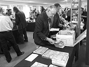
There was a book stall with special conference offers which proved popular in the break periods.
This was a challenging day for the non-professional in the Archaeological field but was most interesting with a variety of subjects covered by speakers who were fully versed in their subjects. A very wide range of subject matter was covered which ensured the day had something for everyone and, going by comments overheard at the breaks and over lunch, there was much to provoke thought.
The organisation was first class, slick and efficient and the day seemed to pass very quickly which is an excellent indicator of the success of the event.
< Previous